Map Resources
David Lynch (david at cdly.org)
Make your own shaded relief maps
Download geotif elevation maps:
The USGS moved to a new data server system, and I
have never gotten it to work for me since.
Right now I don't know how to download the data, sad.
Download geotif map viewer:
http://www.visualizationsoftware.com/3dem
or Google "3DEM" to find it and other tips.
Sometimes I have to re-install it from the installation file I have saved.
You open the program and then use it to open up your geotiff file.
Play with the options to see how they work (such has changing colorbar,
elevation range).
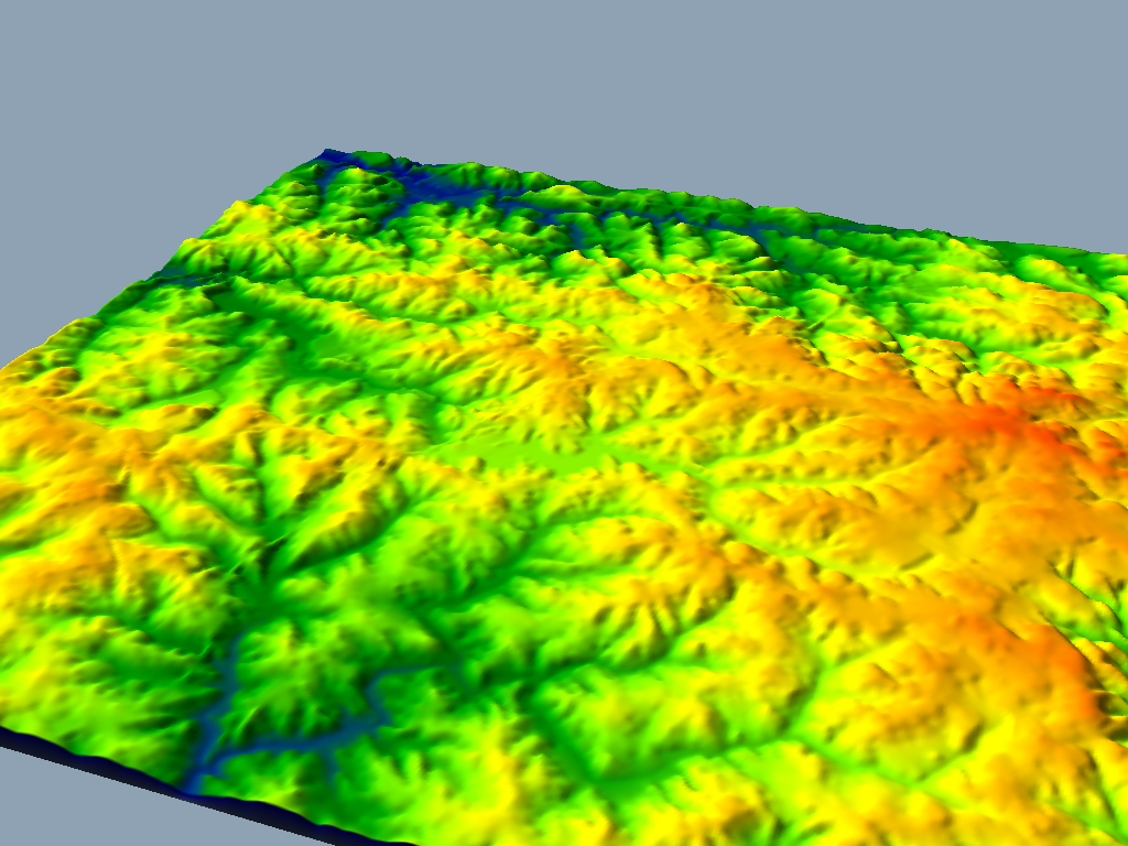
Samples of maps made by the author
(use your back button to return from these)
See here for USGS copyright information http://www.usgs.gov/laws/info_policies.html
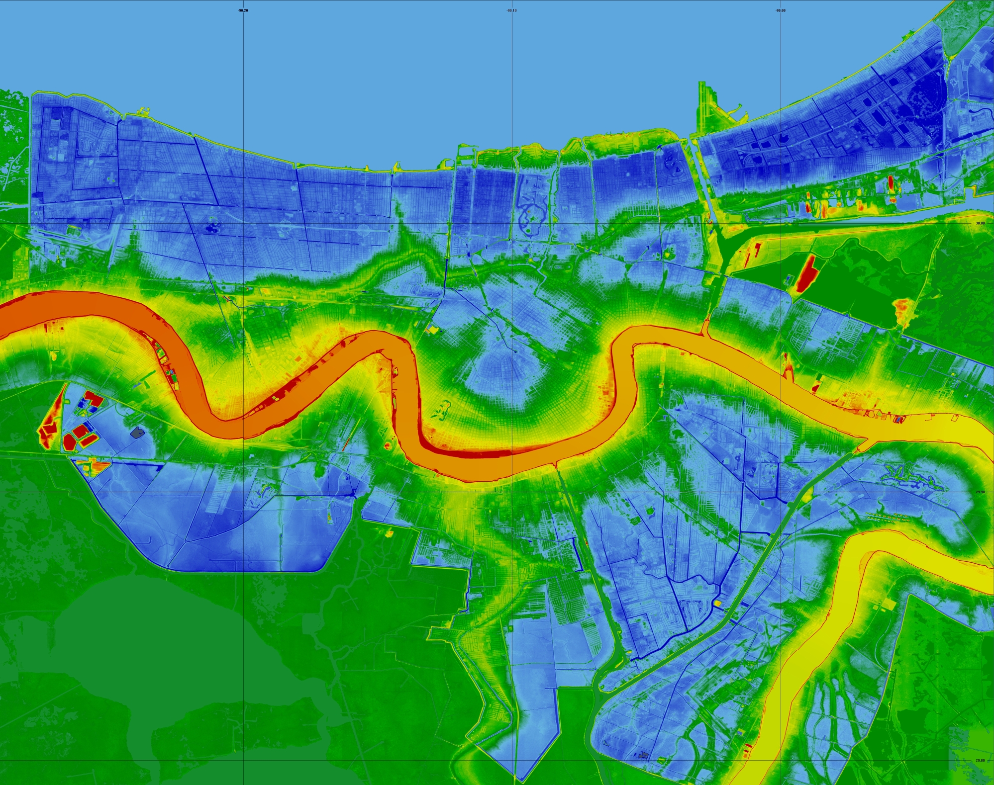
New Orleans Elevation (data can actually be displayed in 3DEM at 4X this scale) Blue areas are below sea level (colors darken with increasing depth).
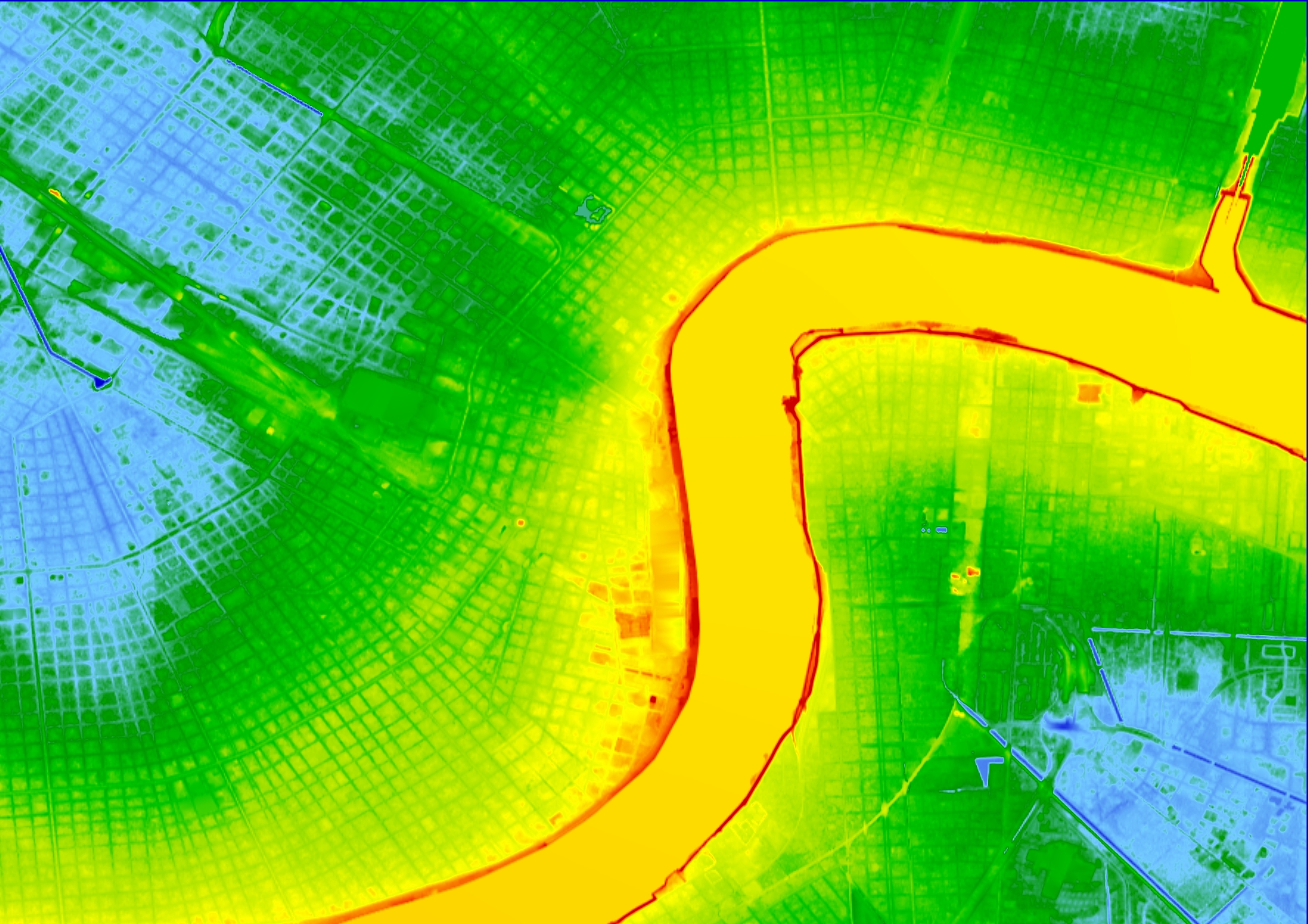
Zoom-in on New Orleans Downtown (note Lee Circle & Jackson Square, the Superdome building is a rectangle)
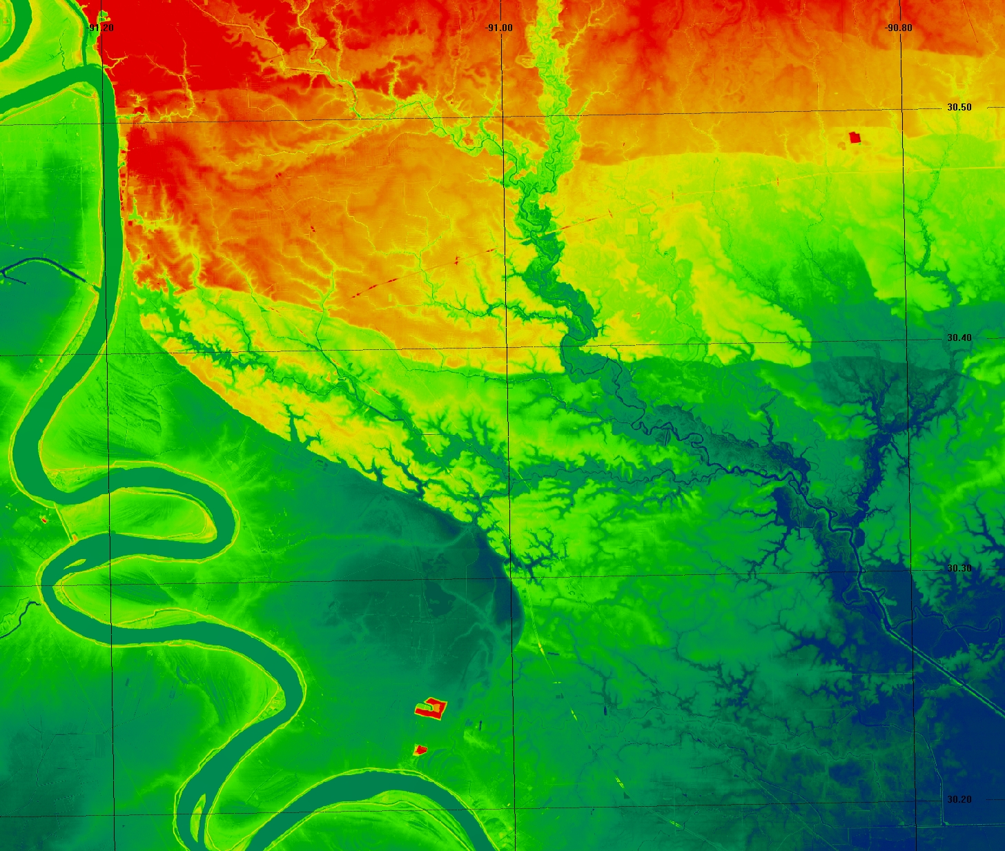
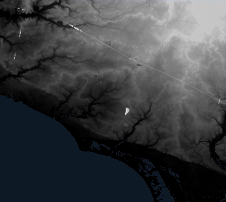
Baton Rouge I-10 and I-12 stand out
because of the embankments on the overpasses. Note the faults;
also interesting <near Prairieville> is how a Mississippi River backswamp
drains to Lake Pontchartrain through an incision on the Pleistocene
Terrace.
This is similar to what the Vermillion Rover does at Lafayette (next image).
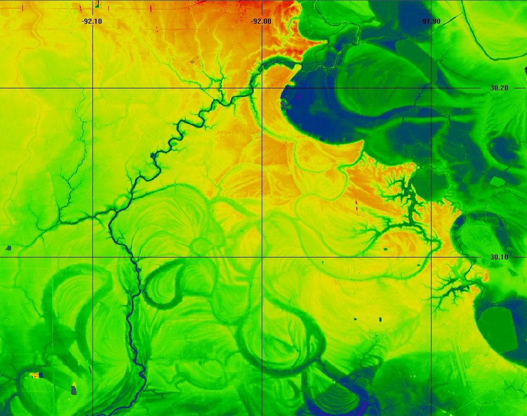
Lafayette, LA. - Lafayette is at the top-center edge. To the right is the modern Mississippi River Floodplain (actually the backswamps of the Bayou Teche phase, Bayou Teche is at the upper right. There is a older, higher meander belt (from earlier high stand) on the terrace filling the west. The Vermillion River originates in the Bayou Teche backswamp and cuts across the older terrace to reach the Gulf. It starts it's cut using part of the depression due to a terrace meander. I have read that the older meanders are blanketed with loess (don't remember the citiation). Note the fault that cuts the meander belt in the southeast.
Lafayette Meander Belt - zoomed out (the previous map is in the upper right corner). Displayed in gray scale to highlight the meander belt trending southwest from Lafayette. The dark area to upper right is the Recent Mississippi valley fill. Note faults that drop the southeast portion down. Jefferson Island and Avery Island domes are clipped white. In the northwest you can see some paleo distributary channel/ridges. The next map shows this sort of thing more clearly.
Northshore of Lake Pontchartrain (Mandeville/Covington to Lacombe/Slidell) For location, note overpasses along I-12, Causeway, and I-10. Modern Pearl River Basin is dark area in upper right, Tchefuncta River at left. You can see that this area was laid down in a prior interglacial high stand by distributaries of the ancestral Pearl River. There are remnants of meandering distributaries visible in the high grounds, and modern drainages are in the inter-distributary lows (except Bayou LaCombe is more complicated) Note also fault scarps.
Zoomed-in version near Mandeville with stronger elevation contrast.
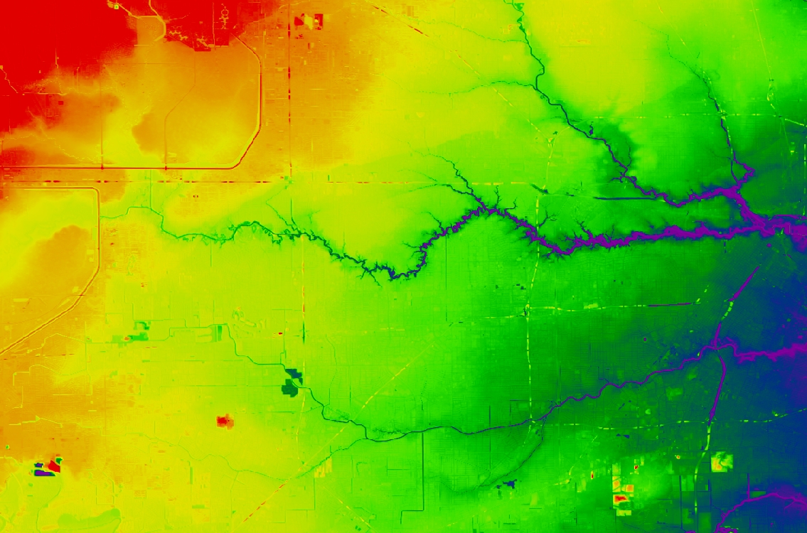
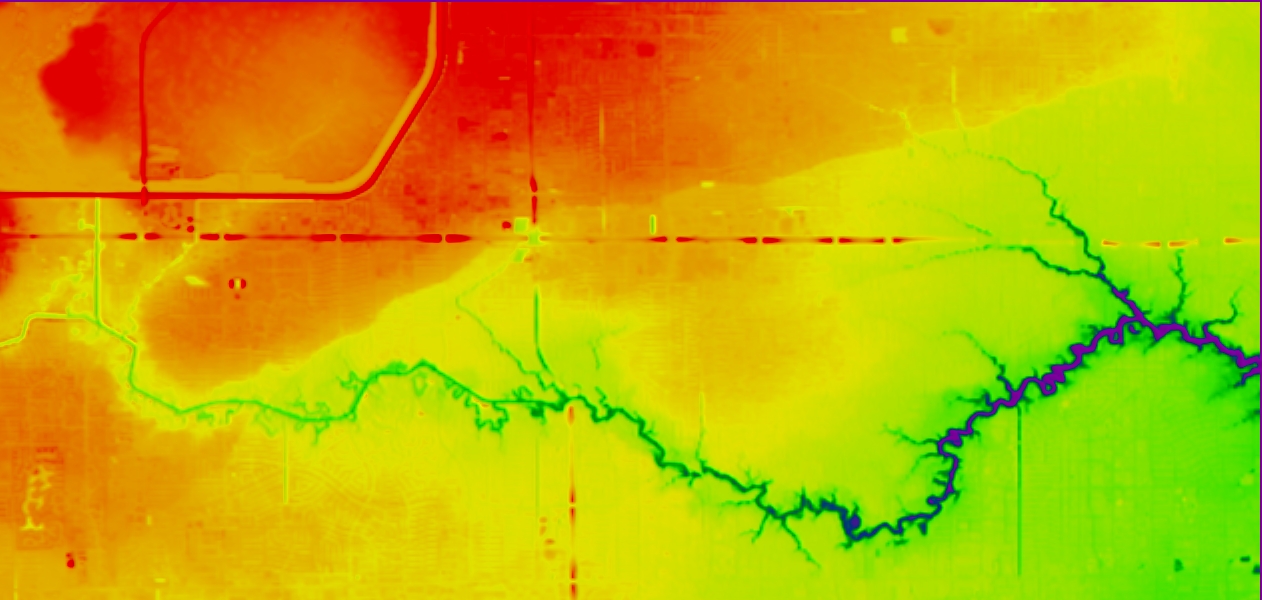
West Houston - downtown is at right edge, Barker & Addicks Dams on left. Note Buffalo Bayou and the interstate highways. You can see hints of Long Point fault.
Long Point Fault (zoom in). Center is near Beltway and Katy Freeway. In 1983 someone pointed out the bump i the Freeway to me and I mapped the fault out by driving in my pickup truck!
San Francisco I used-to have a "Go climb a street!" T-shirt.
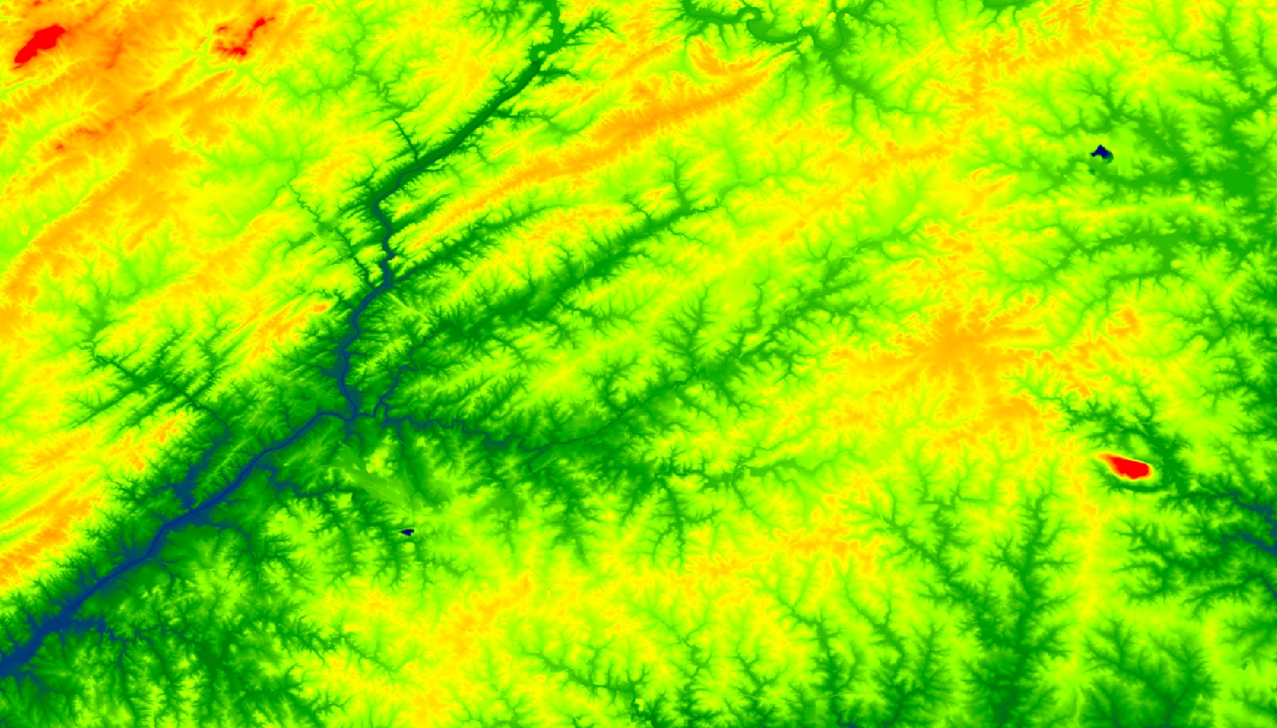
Atlanta - topography shown in color without the shaded relief. Note the SW-NE striping inherited from the Appalachian Orogeny. Some streams exploit fractures perpendicular to this trend. The Piedmont Region has numerous Triassic Dikes parallel to these fractures. Quarries are blue holes.
Tucker Georgia oblique view Subset of the Atlanta area rendered with one of the 3DEM tools. My childhood home is near the center.
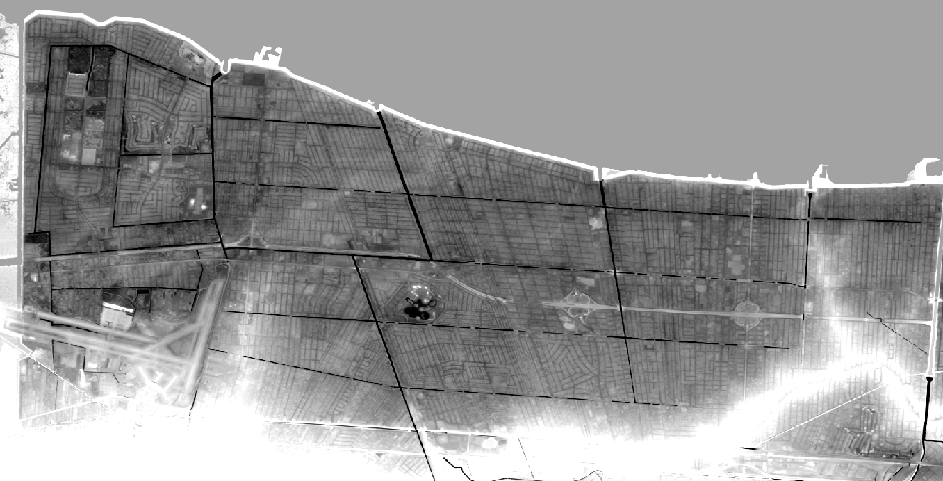
Kenner-Metairie Gray - zoom-in on Kenner-Metairie with gray color-scale and elevation clipping chosen to highlight subtle distributary features in the former marshes between Metairie Ridge and the lake.